HARTFORD, CT — Connecticut moved into its third consecutive day of 90-degree or hotter temperatures, officially marking a heat wave and making it the fifth-earliest such stretch on record in the state. Forecasters said the warm pattern is not ending immediately, with temperatures expected to stay near 90 degrees again Wednesday. The combination of persistent heat and humid conditions is keeping summer weather locked in across the state. A stronger round of storms is also possible later in the day, raising the chance of severe weather after the hot afternoon.
Heat Wave Marks Early Season
The current stretch stands out because of how early it arrived in the season. State weather records show this is Connecticut’s fifth-earliest heat wave on record, underscoring how quickly summer-like conditions have taken hold. The milestone comes after three straight days of 90-plus temperatures, the threshold used to define a heat wave in this report. While the source does not list individual city readings, it makes clear the warmth is widespread enough to qualify statewide. The broader pattern has been one of sustained heat rather than a brief spike, which is why the hot weather is drawing attention now.
That kind of early heat can affect routines even when the forecast does not show extreme records. The key message from forecasters is that residents should expect another warm day before relief arrives. For many households, that means continuing to manage indoor cooling, outdoor activity, and the timing of travel or chores around the afternoon warmth. The main weather story remains the same: summer heat is here early, and it is not done yet.
Wednesday Brings More Heat
Wednesday is expected to stay hot, with highs around 90 degrees once again. That means the state will likely remain in the heat wave for at least another day, extending the streak of uncomfortable conditions. The source notes that the heat should stick around tomorrow, which suggests little immediate break from the warm air mass over Connecticut. Even without a major temperature jump, the continued presence of 90-degree highs keeps the forecast squarely in heat-wave territory. The pattern also leaves little room for the day to cool off before evening.
The forecast is especially important because the heat comes before a better chance of strong thunderstorms later Wednesday. That combination can create changing conditions over a short period of time, with a hot start to the day followed by a more unsettled stretch later on. The source does not specify exact timing or locations for the storms, but it does indicate the threat is higher tomorrow than it is today. That makes Wednesday the most weather-active day in the immediate forecast.
Storm Risk Returns Wednesday
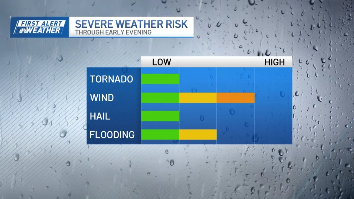
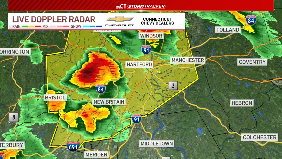
Along with the heat, forecasters are watching for a better chance of strong or severe thunderstorms on Wednesday. The warning that severe thunderstorm alerts had expired suggests the immediate storm threat was easing, but the atmosphere remains unstable enough for another round later. The source does not say whether any storms will reach warning criteria, only that the odds are improved. In practical terms, that means residents should stay aware of changing conditions during the day and into the evening. Hot, humid air can help fuel fast-moving storms when the setup turns favorable.
The mention of strong and severe thunderstorms is the most notable short-term hazard in the forecast. Even if storms stay scattered, they can bring brief heavy rain, gusty wind, lightning, and sudden reductions in visibility. The report does not include any damage or outages, only the possibility of renewed storm development. For now, the weather picture is shifting from one concern to another: after the heat wave peaks, thunderstorms may become the next issue to watch.
Cooler Air Arrives Thursday
Relief is expected by Thursday, when highs are forecast to fall to around 70 degrees. That would be a noticeable drop from the 90-degree heat of the previous days and a sign that the warm spell is breaking. The cooling trend should bring a much more comfortable afternoon and lower the immediate stress of the heat wave. The source does not provide a detailed explanation for the change, but the forecast clearly points to a cooler pattern arriving after the midweek warmth. That makes Thursday the transition day in this short-range outlook.
The swing from near 90 on Wednesday to around 70 on Thursday is a sharp reminder of how quickly New England weather can change. After several hot days, the lower temperature should provide a break for anyone affected by the heat. Forecasters are signaling that the state’s brief early-summer surge will not last much longer. For Connecticut, the immediate weather story is a two-step turn: one more hot day with storm potential, then a cooler finish to the week.