BOSTON, MA — A slow-moving weather system is bringing several days of rain and the risk of flooding to Massachusetts and parts of Connecticut. A severe thunderstorm warning was in effect for portions of western and central Massachusetts, while a flood watch covered parts of Massachusetts and Connecticut through Wednesday. Forecasters said the heaviest rain was expected Wednesday, with Greater Boston included in the threat area. Officials urged drivers to avoid flooded roads and to turn around rather than try to cross standing water.
Heavy Rain Through Midweek
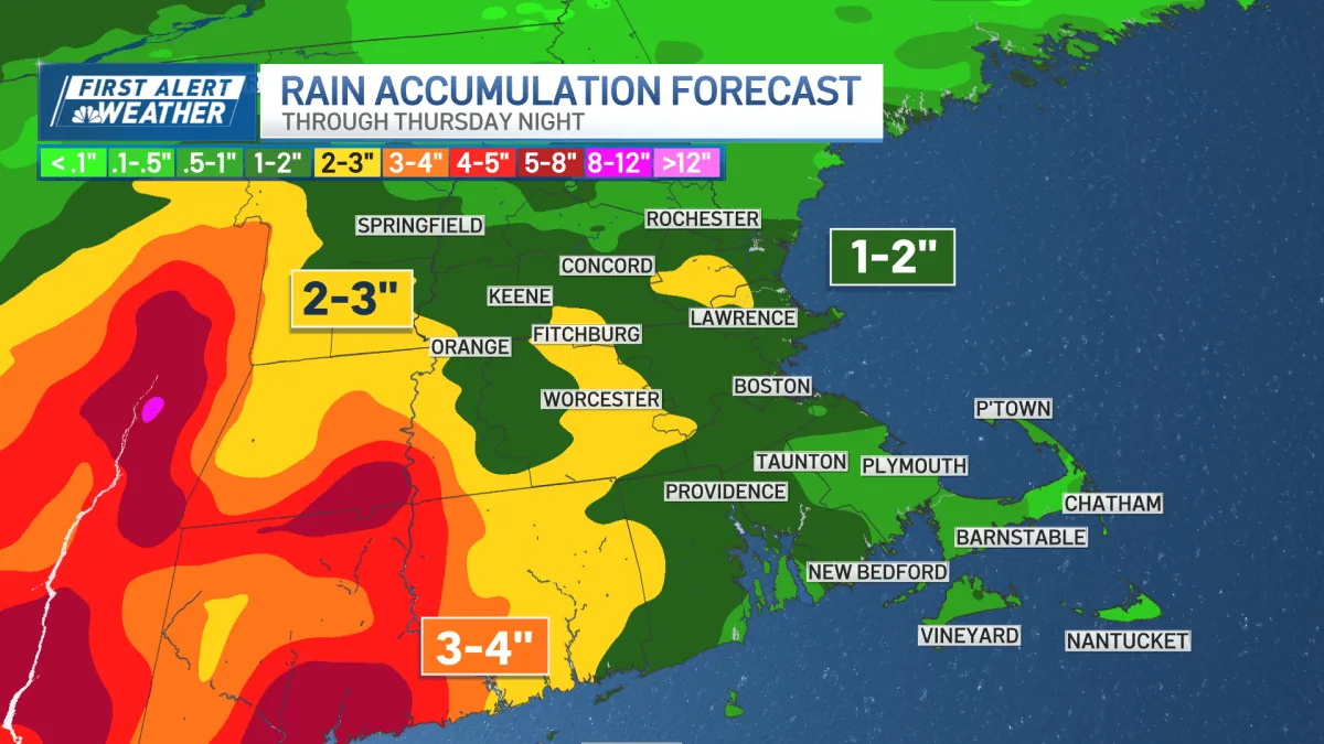
Rain began to spread across the region Tuesday as the low-pressure system moved slowly overhead. That sluggish pace is what makes the situation a concern, because it keeps the chance for showers, downpours and storms in place for more than one day. Wednesday was labeled a First Alert day, with heavy rain and flash flooding identified as the main hazards. Some communities under the flood watch could receive between two and three inches of rain before the system moves on.
Wind, Humidity And Temperatures
The wet weather will not be the only noticeable change. Winds are expected to increase Wednesday, with gusts reaching 30 to 35 mph and stronger gusts possible on the Cape and Islands. Humidity also is expected to stay elevated from Tuesday through the weekend, making the air feel muggy across Boston and surrounding areas. Temperatures should hold in the 80s on Tuesday before dropping into the upper 60s and lower 70s on Wednesday and Thursday as the rain continues.
Thursday And Friday Outlook
Showers and perhaps a thunderstorm are expected to linger into Thursday, keeping the region damp after the heaviest rain passes. The chance for rain should begin to ease by Friday, offering a gradual break from the midweek system. Even then, conditions may remain unsettled enough to keep a passing shower in play. For people commuting or running errands, the main message remains to watch for ponding on roads and changing conditions during the storm’s slower exit.
Drier Weather Arrives
By Saturday, drier weather is expected to move in across southern New England. That should bring a more comfortable end to the stretch of rain, though the week will have been marked by a significant soaking for many communities. The forecast also serves as a reminder that even routine rainstorms can create problems when they move slowly and overlap with already saturated ground. For now, the focus remains on getting through Wednesday’s heaviest rain and the flood threat that comes with it.